Geomechanics.io

  • Free Tools
Sign UpLog In

Geomechanics.io

Geomechanics, Streamlined.

© 2026 Geomechanics.io. All rights reserved.

Geomechanics.io

CMRR-ioGEODB-ioHYDROGEO-ioQCDB-ioFree Tools & CalculatorsBlogLatest Industry News

Industries

MiningConstructionTunnelling

Company

Terms of UsePrivacy PolicyLinkedIn
    Projects
    Sustainability
    Safety

    Brownfield success: integrated ground data workflows for project teams

    May 6, 2026|

    Reviewed by Tom Sullivan

    Brownfield success: integrated ground data workflows for project teams

    First reported on Geoengineer.org – News

    30 Second Briefing

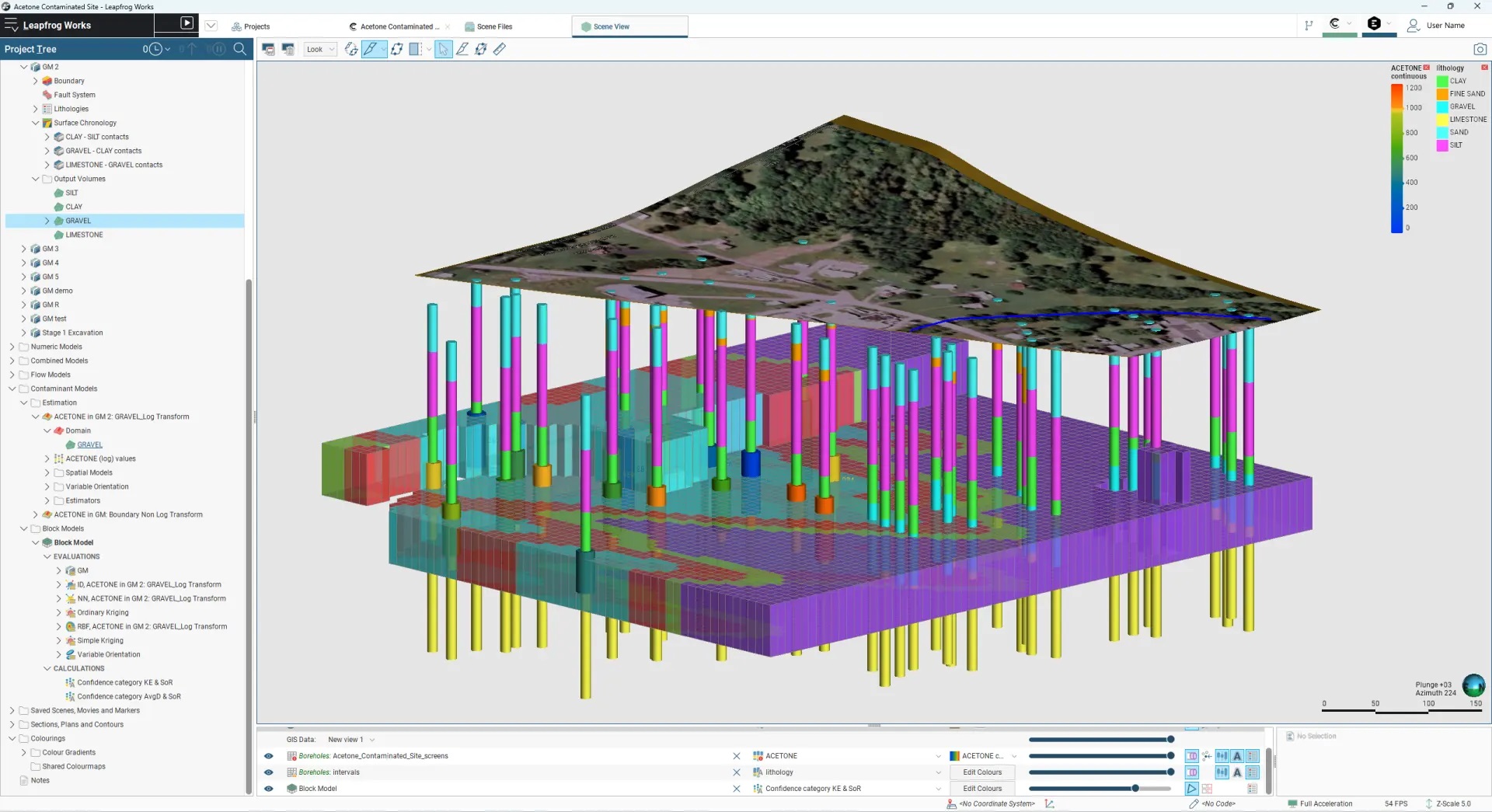
    Brownfield infrastructure projects are seeing geotechnical and environmental teams urged to integrate ground investigation, contamination data and 3D ground models from the outset, rather than running parallel site characterisation workflows. The piece stresses unified digital datasets combining borehole logs, in situ test results and contaminant plumes to refine ground risk registers, optimise foundation and earthworks design, and avoid late-stage remediation surprises. Case experience shows that early joint modelling of variable made ground, buried obstructions and legacy industrial pollution can materially cut unforeseen ground conditions claims and programme delays.

    Technical Brief

    • Digital workflows are described as reducing conflicting advice between geotechnical and environmental consultants, a known safety and liability issue.
    • For similar brownfield infrastructure schemes, integrated datasets are framed as essential to meeting tightening occupational exposure and remediation compliance limits.

    Geotechnical Software for Modern Teams

    Centralise site data, logs, and lab results with GEODB-io, CMRR-io, and HYDROGEO-io.

    No credit card required.

    • Save and export unlimited calculations
    • Advanced data visualisation
    • Generate professional PDF reports
    • Cloud storage for all your projects

    Prepared by collating external sources, AI-assisted tools, and Geomechanics.io’s proprietary mining database, then reviewed for technical accuracy & edited by our geotechnical team.

    Related Articles
    BGS UK ground investigation data service: design and risk notes for engineers
    Geotechnical
    4 days ago

    BGS UK ground investigation data service: design and risk notes for engineers

    The British Geological Survey is advancing a national geotechnical data service to collate UK ground investigation records into a single, standardised digital platform for project teams. By aggregating borehole logs, in situ test results and laboratory data from multiple legacy sources, the system aims to give designers earlier visibility of variable strata, groundwater conditions and historical contamination. For geotechnical and civil engineers, this could reduce duplicate site investigations, refine ground models at concept stage and improve risk pricing for foundations, earthworks and underground structures.

    Amids South 93m bridge: design lessons on weak ground for geotechnical engineers
    Geotechnical
    6 days ago

    Amids South 93m bridge: design lessons on weak ground for geotechnical engineers

    A 93m-long bridge over the White Cart Water forms the core of the Amids South transport scheme, linking an existing industrial area to Paisley town centre and Glasgow Airport. Poor ground conditions along the river corridor drove a redesign of the substructure, with foundations and pier locations adjusted to avoid weak strata and reduce settlement risk. The scheme’s experience will interest geotechnical and bridge engineers dealing with soft alluvium and variable bearing capacity on constrained urban river crossings.

    Gary L. Seider P.E.: helical foundation design lessons for ground engineers
    Geotechnical
    8 days ago

    Gary L. Seider P.E.: helical foundation design lessons for ground engineers

    Gary L. Seider, P.E., is retiring after nearly 40 years with A.B. Chance, where he was instrumental in developing helical pile and anchor systems that became core to Hubbell’s foundation solutions portfolio after its 1994 acquisition. His work helped formalise design methodologies, installation torque–capacity correlations and training standards for contractors and engineers using screw anchors in transmission, distribution and commercial foundation projects. Seider’s legacy is a mature, codified helical foundation practice that many US geotechnical and structural engineers now treat as a routine design option.

    Related Industries & Products

    Construction

    Quality control software for construction companies with material testing, batch tracking, and compliance management.

    Mining

    Geotechnical software solutions for mining operations including CMRR analysis, hydrogeological testing, and data management.

    CMRR-io

    Streamline coal mine roof stability assessments with our cloud-based CMRR software featuring automated calculations, multi-scenario analysis, and collaborative workflows.

    HYDROGEO-io

    Comprehensive hydrogeological testing platform for managing, analysing, and reporting on packer tests, lugeon values, and hydraulic conductivity assessments.

    GEODB-io

    Centralised geotechnical data management solution for storing, accessing, and analysing all your site investigation and material testing data.

    AllGeotechnicalMiningInfrastructureMaterialsHazardsEnvironmentalSoftwarePolicy