Geomechanics.io

  • Free Tools
Sign UpLog In
AllGeotechnicalMiningInfrastructureMaterialsHazardsEnvironmentalSoftwarePolicy

Geomechanics.io

Geomechanics, Streamlined.

© 2026 Geomechanics.io. All rights reserved.

Geomechanics.io

CMRR-ioGEODB-ioHYDROGEO-ioQCDB-ioFree Tools & CalculatorsBlogLatest Industry News

Industries

MiningConstructionTunnelling

Company

Terms of UsePrivacy PolicyLinkedIn
    Research
    Projects

    North Sea geology and cable burial: BGS findings and design lessons for engineers

    July 6, 2026|

    Reviewed by Tom Sullivan

    North Sea geology and cable burial: BGS findings and design lessons for engineers

    First reported on New Civil Engineer

    30 Second Briefing

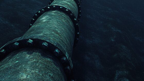
    New British Geological Survey mapping of the upper 2m of seabed across the UK North Sea shows highly variable near-surface geology, challenging assumptions of relatively uniform sands used in many cable burial designs. The work identifies rapid lateral changes between sands, gravels, soft sediments and lag deposits at scales relevant to ploughs and jetting tools, with implications for trench stability, target burial depths and pull-out resistance for subsea power and telecoms cables. Designers may need denser geophysical and geotechnical sampling and more adaptable burial equipment specifications.

    Technical Brief

    • BGS mapping targets the upper 2 m of seabed stratigraphy across the UK North Sea.

    Our Take

    BGS’s detailed mapping of the upper 2 m of the UK North Sea seabed sits alongside its separate programme to assess CO₂ storage potential in Central North Sea sandstones, signalling that future offshore carbon storage layouts will need to account for more intricate near-seabed conditions when routing wells, manifolds and export lines.

    In our database, BGS’s North Sea work now spans both climate-driven onshore subsidence risk and offshore ground characterisation, giving UK infrastructure planners a more continuous picture from landfall to subsea assets that can be fed into early project optioneering rather than left to late-stage marine ground investigations.

    The push by BGS to build a national geotechnical data service means these new UK North Sea seabed datasets are likely to be standardised and reusable across multiple offshore wind, interconnector and CCS projects, reducing duplicated site investigation spend but also exposing inconsistencies in legacy marine ground models that designers will need to reconcile.

    Geotechnical Software for Modern Teams

    Centralise site data, logs, and lab results with GEODB-io, CMRR-io, and HYDROGEO-io.

    No credit card required.

    • Save and export unlimited calculations
    • Advanced data visualisation
    • Generate professional PDF reports
    • Cloud storage for all your projects

    Prepared by collating external sources, AI-assisted tools, and Geomechanics.io’s proprietary mining database, then reviewed for technical accuracy & edited by our geotechnical team.

    Related Articles
    Coates’ new electric dewatering fleet: design implications for urban geotechnical works
    Geotechnical
    2 days ago

    Coates’ new electric dewatering fleet: design implications for urban geotechnical works

    Coates has expanded its engineered dewatering capability with a new fleet of electric BBA Pumps, including PT200 D265 (8″/200mm), PT150 D185 (6″/150mm) and PT100 D130 (4″/100mm) units for urban construction sites. The electric configuration targets groundwater control on projects from small residential excavations to complex basements, water assets and civil infrastructure in dense urban areas where diesel emissions, noise and access constraints are critical. For geotechnical and civil contractors, the range allows closer-to-face installation and longer runtimes on grid power, simplifying dewatering design and temporary works planning.

    The Observational Method: practical adoption barriers and value for ground engineers
    Geotechnical
    3 days ago

    The Observational Method: practical adoption barriers and value for ground engineers

    The Observational Method in ground engineering is regaining interest as major infrastructure schemes look to manage geotechnical uncertainty in real time rather than rely solely on conservative design factors. Engineers are revisiting staged construction with predefined trigger levels, instrumented slopes and retaining walls, and adaptive support measures, but uptake remains patchy due to contractual risk allocation, programme pressures, and limited monitoring budgets. Wider use could cut unnecessary pile lengths, excavation support thicknesses and contingency allowances, provided clients accept flexible design envelopes and robust monitoring–response plans.

    £2.7M Welsh landfill solar farm: design and settlement notes for engineers
    Geotechnical
    3 days ago

    £2.7M Welsh landfill solar farm: design and settlement notes for engineers

    Newport City Council has issued a £2.7M procurement for a solar farm and battery energy storage system at the capped Docks Way Landfill Site in Newport, South Wales, aiming to convert the former waste facility into a grid-connected renewable energy asset. The design-and-build contract will need to address foundation detailing on landfill cover, settlement behaviour and gas management, as well as integrating the BESS with local distribution network constraints. Civil and geotechnical bidders will be expected to manage construction over waste, including differential settlement and leachate control.

    Related Industries & Products

    Mining

    Geotechnical software solutions for mining operations including CMRR analysis, hydrogeological testing, and data management.

    Construction

    Quality control software for construction companies with material testing, batch tracking, and compliance management.

    HYDROGEO-io

    Comprehensive hydrogeological testing platform for managing, analysing, and reporting on packer tests, lugeon values, and hydraulic conductivity assessments.

    GEODB-io

    Centralised geotechnical data management solution for storing, accessing, and analysing all your site investigation and material testing data.