Geomechanics.io

  • Free Tools
Sign UpLog In
AllGeotechnicalMiningInfrastructureMaterialsHazardsEnvironmentalSoftwarePolicy

Geomechanics.io

Geomechanics, Streamlined.

© 2026 Geomechanics.io. All rights reserved.

Geomechanics.io

CMRR-ioGEODB-ioHYDROGEO-ioQCDB-ioFree Tools & CalculatorsBlogLatest Industry News

Industries

MiningConstructionTunnelling

Company

Terms of UsePrivacy PolicyLinkedIn
    Safety
    Sustainability
    Projects

    Birmingham flash floods: surface‑first drainage lessons for urban designers

    August 28, 2026|

    Reviewed by Tom Sullivan

    Birmingham flash floods: surface‑first drainage lessons for urban designers

    First reported on New Civil Engineer

    30 Second Briefing

    Flash flooding in Birmingham on 27 August, triggered by intense short‑duration rainfall on parched, largely impermeable urban surfaces, overwhelmed a combined sewer network sized for historic return periods rather than today’s convective storm patterns. Drainage specialists are calling for a “surface‑first” strategy using blue‑green infrastructure such as swales, rain gardens and permeable paving to attenuate runoff before it reaches pipes. For designers, the event reinforces the need to prioritise exceedance routing, overland flow paths and retrofit SuDS over simply upsizing buried sewers.

    Technical Brief

    • Event occurred on 27 August in Birmingham, with intense localised rainfall causing rapid surface ponding.
    • Short storm duration concentrated peak runoff into minutes, giving minimal response time for operational interventions.
    • Parched ground conditions reduced initial infiltration, so almost all rainfall converted directly to surface runoff.
    • Combined foul–surface water sewers received high inflows from roads and roofs simultaneously, compounding surcharge risk.
    • Flooding affected multiple carriageways and underpasses, indicating exceedance flows were not safely routed to low‑risk areas.
    • Urban hardstanding and limited vegetated cover in affected districts increased effective impermeable catchment area to near 100%.
    • For safety planning, incident underlines need to map pedestrian/vehicle flood hazard zones and emergency diversion routes.
    • Similar UK conurbations with legacy combined systems and dense hardstanding face comparable short‑lead‑time flood risk exposure.

    Our Take

    New Civil Engineer’s parallel coverage of BIM and asset-management data handover suggests an opportunity to link surface-first drainage design in the United Kingdom with better digital records of permeable surfaces, SuDS assets and exceedance routes for long-term operation.

    Because this incident is tagged to both Safety and Sustainability, it aligns with a subset of Hazards pieces where flood risk is treated not just as an emergency-response issue but as a driver for project-level design standards and retrofit priorities in existing urban areas.

    Geotechnical Software for Modern Teams

    Centralise site data, logs, and lab results with GEODB-io, CMRR-io, and HYDROGEO-io.

    No credit card required.

    • Save and export unlimited calculations
    • Advanced data visualisation
    • Generate professional PDF reports
    • Cloud storage for all your projects

    Prepared by collating external sources, AI-assisted tools, and Geomechanics.io’s proprietary mining database, then reviewed for technical accuracy & edited by our geotechnical team.

    Related Articles

    Acorn adds commercial manager: implications for asbestos project delivery and safety
    Hazards
    22 days ago

    Acorn adds commercial manager: implications for asbestos project delivery and safety

    Asbestos management consultancy Acorn Analytical Services has appointed Ben James as commercial manager to lead its sales team and secure larger, more complex consultancy and removal projects. James, a former apprentice carpenter and joiner, moved into asbestos work in his early twenties after his grandfather died from asbestosis and has since progressed from trainee asbestos surveyor to contract manager over nine years. He will oversee new technical enquiries, key account management and site visits, and is qualified to deliver asbestos awareness, non-licensed removal and duty-to-manage training under a Level 3 teaching qualification.

    Coalsnaughton mine subsidence demolitions: geotechnical lessons for engineers
    Hazards
    24 days ago

    Coalsnaughton mine subsidence demolitions: geotechnical lessons for engineers

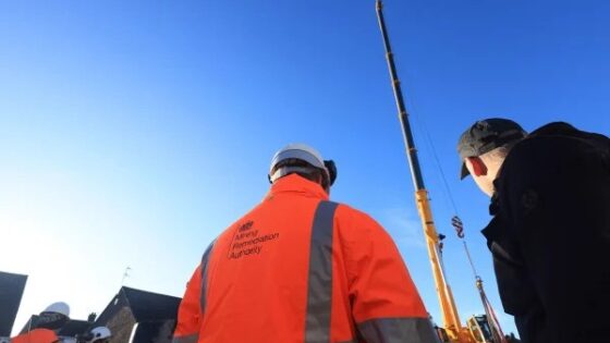
    Homes on Benbuck View and Dunmoss View in Coalsnaughton, Clackmannanshire are to be demolished after Mining Remediation Authority investigations confirmed historic underground workings had caused active mine subsidence beneath the two streets. The decision follows visible ground movement reported on 18 May and subsequent detailed geotechnical assessments that ruled out practical stabilisation options for the affected plots. Engineers will now need to manage demolition, backfilling and long-term ground monitoring, with implications for foundations and service corridors on adjacent properties built over former coal measures.

    LondonEnergy Wembley Waste Transfer Station fire: structural and fire design lessons
    Hazards
    28 days ago

    LondonEnergy Wembley Waste Transfer Station fire: structural and fire design lessons

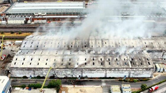
    A major fire at LondonEnergy’s Wembley Waste Transfer Station on Hannah Close, Neasden, has required 20 fire engines and about 125 firefighters to bring the blaze under control. The incident at the enclosed waste-handling facility raises immediate concerns over structural integrity of steel frames, cladding performance under high thermal loads, and potential damage to concrete slabs from prolonged heating and quenching. Engineers will need rapid assessment of fire spread pathways through waste stockpiles and building services to inform repairs, resilience upgrades and future fire-separation design.

    Related Industries & Products

    Construction

    Quality control software for construction companies with material testing, batch tracking, and compliance management.

    Mining

    Geotechnical software solutions for mining operations including CMRR analysis, hydrogeological testing, and data management.

    CMRR-io

    Streamline coal mine roof stability assessments with our cloud-based CMRR software featuring automated calculations, multi-scenario analysis, and collaborative workflows.

    HYDROGEO-io

    Comprehensive hydrogeological testing platform for managing, analysing, and reporting on packer tests, lugeon values, and hydraulic conductivity assessments.

    GEODB-io

    Centralised geotechnical data management solution for storing, accessing, and analysing all your site investigation and material testing data.