Geomechanics.io

  • Free Tools
Sign UpLog In

Geomechanics.io

Geomechanics, Streamlined.

© 2026 Geomechanics.io. All rights reserved.

Geomechanics.io

CMRR-ioGEODB-ioHYDROGEO-ioQCDB-ioFree Tools & CalculatorsBlogLatest Industry News

Industries

MiningConstructionTunnelling

Company

Terms of UsePrivacy PolicyLinkedIn
    AllGeotechnicalMiningInfrastructureMaterialsHazardsEnvironmentalSoftwarePolicy
    Product
    Projects

    National Grid Triton digital twin: what 70% faster planning means for engineers

    January 30, 2026|

    Reviewed by Joe Ashwell

    National Grid Triton digital twin: what 70% faster planning means for engineers

    First reported on New Civil Engineer

    30 Second Briefing

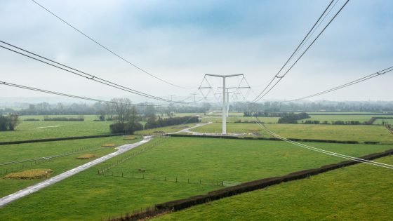
    National Grid has deployed Triton, a digital twin and data visualisation platform developed with Atos, to model future electricity demand at grid supply points and transmission substations and cut infrastructure planning time by up to 70%. The tool integrates asset, demand and network constraint data to test reinforcement options virtually, allowing planners to compare multiple substation upgrade and new connection scenarios before committing to physical design. Faster optioneering is expected to de-risk programme delivery for major connections, including utility-scale renewables and high-load industrial customers.

    Technical Brief

    • Triton builds a spatially-referenced digital twin of grid supply points and transmission substations across England and Wales.
    • The platform ingests historic load profiles and forecast demand data to stress-test nodal capacity over time.
    • Constraint modelling includes thermal ratings, voltage limits and known outage windows on existing transmission circuits.
    • Users can overlay planned generation and demand connections to see coincident loading at individual substations.
    • Scenario runs are executed centrally, with planners accessing results through a browser-based visualisation interface.
    • Governance features track which datasets, assumptions and time horizons underpin each reinforcement scenario.

    Our Take

    Among the 24 Software stories in our coverage, very few deal with planning-time reductions on the order of the 70% claimed here, which suggests National Grid’s Triton could become a reference case for digital consenting tools in linear infrastructure.

    Because Triton is being developed with Atos rather than a niche engineering vendor, utilities and transmission operators watching this project may see it as a template for pairing large IT integrators with in‑house grid planners to tackle bottlenecks in route selection and stakeholder mapping.

    For project-delivery teams, a 70% cut in planning time for electricity infrastructure implies that downstream constraints—such as environmental approvals and land access negotiations—are likely to become the new critical path, shifting where resources and digital tooling need to be focused next.

    Geotechnical Software for Modern Teams

    Centralise site data, logs, and lab results with GEODB-io, CMRR-io, and HYDROGEO-io.

    No credit card required.

    • Save and export unlimited calculations
    • Advanced data visualisation
    • Generate professional PDF reports
    • Cloud storage for all your projects

    Prepared by collating external sources, AI-assisted tools, and Geomechanics.io’s proprietary mining database, then reviewed for technical accuracy & edited by our geotechnical team.

    Related Articles

    Sumitomo and NEC AI near-miss analysis: safety and data lessons for site engineers
    Software
    about 4 hours ago

    Sumitomo and NEC AI near-miss analysis: safety and data lessons for site engineers

    Sumitomo Heavy Industries and NEC are jointly developing an AI and computer vision system that uses camera feeds from hydraulic excavators and SHI’s SHICuTe ICT/IoT platform data to automatically detect “risk scenes” and generate structured near-miss reports. NEC’s 2023 video recognition and generative AI technology, previously used for road traffic accident analysis, will fuse time- and location-stamped video with machine operating logs as multimodal data to characterise hazardous and prohibited behaviours. Following a successful proof of concept in September 2025, full development starts April 2026, with global deployment targeted for broader construction-site safety management.

    Software
    about 5 hours ago

    Datamine–Mineware acquisitions: integrated mine management explained for engineers

    Datamine has acquired Mineware Africa and Mineware Consulting to expand its mine management software suite and in‑house advisory capability across exploration, resource modelling, mine planning and operations control. The deal adds Mineware’s production accounting, dispatch and short-interval control tools, along with its implementation consultants, into Datamine’s existing end-to-end digital mining platform. For engineers, the move signals tighter integration between planning, fleet management and production data, potentially simplifying brownfield system upgrades and multi-site standardisation.

    Deswik’s Indonesia expansion: mine planning implementation insights for engineers
    Software
    2 days ago

    Deswik’s Indonesia expansion: mine planning implementation insights for engineers

    Deswik has opened a new office in Jakarta, Indonesia, backed by a local consulting team to support deployment of its mine planning and scheduling software across the country’s open-pit and underground operations. The company will host Deswik Exchange Jakarta on 16 April to showcase practical workflows and case studies drawn from real‑world mining projects. A permanent in‑country team should shorten implementation cycles, improve on‑site training and support, and allow closer integration of Deswik tools with Indonesian regulatory, geotechnical and production planning requirements.

    Related Industries & Products

    Mining

    Geotechnical software solutions for mining operations including CMRR analysis, hydrogeological testing, and data management.

    Construction

    Quality control software for construction companies with material testing, batch tracking, and compliance management.

    CMRR-io

    Streamline coal mine roof stability assessments with our cloud-based CMRR software featuring automated calculations, multi-scenario analysis, and collaborative workflows.

    HYDROGEO-io

    Comprehensive hydrogeological testing platform for managing, analysing, and reporting on packer tests, lugeon values, and hydraulic conductivity assessments.

    GEODB-io

    Centralised geotechnical data management solution for storing, accessing, and analysing all your site investigation and material testing data.