Geomechanics.io

  • Free Tools
Sign UpLog In
AllGeotechnicalMiningInfrastructureMaterialsHazardsEnvironmentalSoftwarePolicy

Geomechanics.io

Geomechanics, Streamlined.

© 2026 Geomechanics.io. All rights reserved.

Geomechanics.io

CMRR-ioGEODB-ioHYDROGEO-ioQCDB-ioFree Tools & CalculatorsBlogLatest Industry News

Industries

MiningConstructionTunnelling

Company

Terms of UsePrivacy PolicyLinkedIn
    Projects

    BGS UK ground investigation data service: design and risk notes for engineers

    May 22, 2026|

    Reviewed by Tom Sullivan

    BGS UK ground investigation data service: design and risk notes for engineers

    First reported on New Civil Engineer

    30 Second Briefing

    The British Geological Survey is advancing a national geotechnical data service to collate UK ground investigation records into a single, standardised digital platform for project teams. By aggregating borehole logs, in situ test results and laboratory data from multiple legacy sources, the system aims to give designers earlier visibility of variable strata, groundwater conditions and historical contamination. For geotechnical and civil engineers, this could reduce duplicate site investigations, refine ground models at concept stage and improve risk pricing for foundations, earthworks and underground structures.

    Technical Brief

    • For similar national initiatives, the main technical challenge is reconciling inconsistent historical coding and stratigraphic nomenclature.

    Our Take

    The British Geological Survey’s push to collate UK ground investigation data aligns with its North Sea CO₂ storage mapping work, signalling a move towards re‑using legacy subsurface datasets across both onshore infrastructure and offshore energy transition projects.

    Within our 23 Geotechnical stories, BGS is one of the few UK-based institutions repeatedly appearing as a data custodian rather than a project proponent, which suggests consultants and asset owners may increasingly depend on BGS-curated datasets as a quasi-standard reference for ground models.

    Geotechnical Software for Modern Teams

    Centralise site data, logs, and lab results with GEODB-io, CMRR-io, and HYDROGEO-io.

    No credit card required.

    • Save and export unlimited calculations
    • Advanced data visualisation
    • Generate professional PDF reports
    • Cloud storage for all your projects

    Prepared by collating external sources, AI-assisted tools, and Geomechanics.io’s proprietary mining database, then reviewed for technical accuracy & edited by our geotechnical team.

    Related Articles
    Growing foundations reuse: investigation, reliability and carbon lessons for engineers
    Geotechnical
    2 days ago

    Growing foundations reuse: investigation, reliability and carbon lessons for engineers

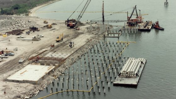
    Reuse of existing piled and raft foundations is accelerating on commercial property schemes as clients accept higher investigation spend in exchange for major embodied carbon and programme savings. Engineers are combining detailed pile integrity testing, targeted coring and advanced geotechnical back‑analysis with updated Eurocode‑based reliability methods to justify reusing legacy foundations originally designed for very different load cases. Planning and funding bodies are now more willing to accept partial reuse strategies, shifting project briefs away from default demolition and full replacement towards selective strengthening, load‑sharing and local pile augmentation.

    Chalk foundations in the UK: investigation and design lessons for engineers
    Geotechnical
    3 days ago

    Chalk foundations in the UK: investigation and design lessons for engineers

    Industry geotechnical specialists at the John Mitchell lecture warned that UK foundation design on chalk is still misjudging key behaviours such as solution features, variable weathering profiles and the risk of brittle collapse under cyclic loading. Speakers pointed to recent pile and shallow foundation projects where inadequate chalk characterisation, limited core recovery and over-reliance on generic SPT correlations led to unexpected settlements and construction delays. Attendees were urged to adopt more rigorous chalk-specific investigation, including targeted boreholes, high-quality sampling and site-specific load testing, before finalising foundation schemes.

    Network Rail £41M North West earthworks: design and risk notes for geotechnical teams
    Geotechnical
    3 days ago

    Network Rail £41M North West earthworks: design and risk notes for geotechnical teams

    Network Rail is delivering £41M of earthworks across key North West rail corridors to improve cuttings and embankments against winter rainfall, freeze–thaw and slope instability. Works are expected to include regrading and strengthening of existing earthwork assets, improved drainage systems and renewed trackside access to reduce washouts, slips and emergency speed restrictions. Geotechnical teams will need to manage construction around live traffic, legacy Victorian earth structures and variable ground conditions typical of the region’s glacial tills and weathered rock.

    Related Industries & Products

    Construction

    Quality control software for construction companies with material testing, batch tracking, and compliance management.

    Mining

    Geotechnical software solutions for mining operations including CMRR analysis, hydrogeological testing, and data management.

    HYDROGEO-io

    Comprehensive hydrogeological testing platform for managing, analysing, and reporting on packer tests, lugeon values, and hydraulic conductivity assessments.

    GEODB-io

    Centralised geotechnical data management solution for storing, accessing, and analysing all your site investigation and material testing data.