Geomechanics.io

  • Free Tools
Sign UpLog In

Geomechanics.io

Geomechanics, Streamlined.

© 2026 Geomechanics.io. All rights reserved.

Geomechanics.io

CMRR-ioGEODB-ioHYDROGEO-ioQCDB-ioFree Tools & CalculatorsBlogLatest Industry News

Industries

MiningConstructionTunnelling

Company

Terms of UsePrivacy PolicyLinkedIn
    AllGeotechnicalMiningInfrastructureMaterialsHazardsEnvironmentalSoftwarePolicy
    Projects
    Sustainability

    Anglo American Bowen Basin eDNA: habitat data and rehab design notes for engineers

    March 5, 2026|

    Reviewed by Joe Ashwell

    Anglo American Bowen Basin eDNA: habitat data and rehab design notes for engineers

    First reported on Australian Mining

    30 Second Briefing

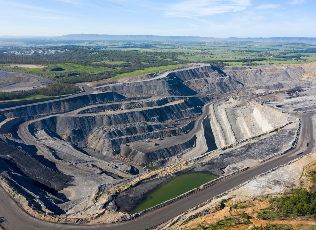
    Anglo American is deploying environmental DNA (eDNA) sampling across its Bowen Basin coal operations, including Capcoal, to verify fauna using rehabilitated waste dumps and tailings areas. Environment teams collect air, water and soil samples to detect species such as microbats, small mammals and birds moving through reshaped and revegetated landforms, complementing traditional trapping and camera surveys. The approach gives mine planners finer-grained data on habitat use and succession, informing design of final landforms, drainage lines and vegetation communities for progressive rehabilitation sign-off.

    Technical Brief

    • Airborne DNA sampling is undertaken using pumps and filters to capture shed skin, fur and faecal particles.
    • Water samples from drainage lines and pit lakes are filtered on-site, then preserved for laboratory metabarcoding.
    • Soil cores are collected from rehabilitated profiles, targeting litter layers and topsoil horizons where DNA persists longest.
    • Laboratory analysis uses high-throughput sequencing against regional reference libraries to assign taxa from mixed DNA traces.
    • Results are spatially mapped over reshaped dumps and tailings surfaces to compare fauna use between rehabilitation ages.
    • Data are integrated with existing ecological monitoring datasets to refine completion criteria for progressive rehabilitation sign-off.
    • Similar eDNA workflows could be adopted at other coal mines to validate habitat function on constructed landforms.

    Our Take

    Within the 12 Environmental stories in our database, Anglo American features disproportionately in Australia-focused rehabilitation and sustainability pieces, signalling that its Bowen Basin work is being used as a flagship for its global ESG positioning.

    Bowen Basin rehabilitation is closely watched in our coverage because the basin hosts multiple long-life coal operations; successful post-mining land-use outcomes here tend to be referenced as benchmarks when regulators and communities assess new project approvals in Queensland.

    With 2059 tag-matched pieces under Projects and Sustainability, nature-based and data-heavy rehabilitation approaches at Australian coal sites like Bowen Basin are emerging as a practical way for operators to demonstrate progressive closure performance without committing to early mine shutdowns.

    Geotechnical Software for Modern Teams

    Centralise site data, logs, and lab results with GEODB-io, CMRR-io, and HYDROGEO-io.

    No credit card required.

    • Save and export unlimited calculations
    • Advanced data visualisation
    • Generate professional PDF reports
    • Cloud storage for all your projects

    Prepared by collating external sources, AI-assisted tools, and Geomechanics.io’s proprietary mining database, then reviewed for technical accuracy & edited by our geotechnical team.

    Related Articles

    Jacobs’ Oldbury environmental baselining: implications for nuclear site design
    Environmental
    3 days ago

    Jacobs’ Oldbury environmental baselining: implications for nuclear site design

    Jacobs has been appointed by Great British Energy – Nuclear to deliver environmental consultancy and baselining at the Oldbury site in Gloucestershire, earmarked as a potential location for a new nuclear power station. The work will characterise existing ground, groundwater, ecological and radiological conditions to support future nuclear site licensing, environmental permits and design optioneering. Early baselining data will be critical for later geotechnical investigations, foundation design, flood and coastal risk assessments, and long-term monitoring strategies if the project proceeds.

    UK Government NbS catchment study: hydrological design notes for engineers
    Environmental
    14 days ago

    UK Government NbS catchment study: hydrological design notes for engineers

    A UK Government research paper concludes that Nature-based Solutions such as floodplain reconnection, riparian woodland and leaky barriers are most effective when planned and modelled across whole catchments rather than as isolated site schemes. The study stresses integrating NbS with existing hard defences, using hydrological and hydraulic modelling to quantify peak flow attenuation and downstream level reductions under design storm events. For civil and drainage engineers, this points to earlier basin-scale option appraisal, multi-landowner agreements and long-term monitoring of storage volumes, infiltration rates and sediment behaviour.

    Dalton Quarry biodiversity bank: BNG design and land-take notes for project teams
    Environmental
    17 days ago

    Dalton Quarry biodiversity bank: BNG design and land-take notes for project teams

    A former Ibstock extraction site, Dalton Quarry, is being converted by Green Earth Developments Group into a biodiversity “bank” of engineered habitats to generate tradable biodiversity net gain (BNG) units for UK infrastructure schemes. The project will create a mosaic of habitat types on previously worked quarry land, allowing developers to purchase pre-accredited BNG units rather than delivering all ecological uplift within constrained project footprints. For civil and geotechnical teams, this model could influence land-take, earthworks design and long-term aftercare obligations on major road, rail and housing projects.

    Related Industries & Products

    Mining

    Geotechnical software solutions for mining operations including CMRR analysis, hydrogeological testing, and data management.

    CMRR-io

    Streamline coal mine roof stability assessments with our cloud-based CMRR software featuring automated calculations, multi-scenario analysis, and collaborative workflows.

    HYDROGEO-io

    Comprehensive hydrogeological testing platform for managing, analysing, and reporting on packer tests, lugeon values, and hydraulic conductivity assessments.

    GEODB-io

    Centralised geotechnical data management solution for storing, accessing, and analysing all your site investigation and material testing data.